Uncategorized files
Jump to navigation
Jump to search
Showing below up to 50 results in range #5,771 to #5,820.
View (previous 50 | next 50) (20 | 50 | 100 | 250 | 500)
 748.10 Iron County Court House.jpg 420 × 286; 43 KB
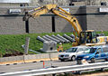
 748.1 Platte 36 Bridge.jpg 800 × 600; 64 KB
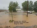
 748.2 Photo Roadway Overtopping.jpg 1,600 × 1,200; 385 KB
 748.2 Photo Roadway Overtopping2.jpg 439 × 298; 28 KB
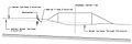
 748.3.5.4 Continuous.jpg 1,524 × 694; 68 KB
 748.3.5.4 Vertical.jpg 1,503 × 720; 67 KB
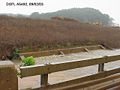
 748.3 Photo Bridge Freeboard.jpg 800 × 600; 80 KB
 748.4.1.jpg 1,335 × 412; 76 KB
 748.4.2.jpg 1,345 × 423; 77 KB
 748.4 Photo Backwater.jpg 640 × 480; 69 KB
 748.5 Photo Matching Existing.jpg 640 × 480; 70 KB
 748.6.1.jpg 872 × 290; 43 KB
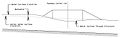
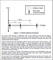
 748.6 Figure Design High Water.gif 744 × 500; 25 KB
 748.7.6.3 Opt 1.jpg 688 × 333; 52 KB
 748.7.6.3 Opt 3.jpg 705 × 338; 56 KB
 748.7.6.3 Videos.jpg 909 × 517; 88 KB
 748.7 Figure Example Bridge Profile.pdf 1,275 × 1,650; 7 KB
 748.7 Figure Example Bridge Survey Plat.pdf 1,275 × 1,650; 7 KB
 748.7 Figure Example Channel Sections.pdf 1,275 × 1,650; 7 KB
 748.7 Figure Example Grade Separation Plan.pdf 1,275 × 1,650; 7 KB
 748.7 Figure Example Grade Separation Profile.pdf 1,275 × 1,650; 7 KB
 748.7 Figure Example Grade Separation Profile over Railroad.pdf 1,275 × 1,650; 7 KB
 748.7 Figure Example Grade Separation Profile without Borings.pdf 1,275 × 1,650; 7 KB
 748.7 Figure Example Skewed Grade Separation Profile over Railroad.pdf 1,275 × 1,650; 7 KB
 748.7 Figure Example Stream Crossing Plan.pdf 1,275 × 1,650; 7 KB
 748.7 Figure Example Stream Crossing Profile.pdf 1,275 × 1,650; 7 KB
 748.7 Figure Spill Slope Clearance at Railroads.pdf 1,275 × 1,650; 7 KB
 748.7 Figure Superstructure Depth Requirements.pdf 1,275 × 1,650; 7 KB
 748.7 Form Bridge Memorandum.doc ; 24 KB
- 748.7 Form BR 105 R.doc ; 155 KB
 748.7 MSE Wall Sample Plans.pdf 1,275 × 1,650; 7 KB
- 748.7 Request for Soundings.doc ; 93 KB
 748.8.jpg 938 × 656; 299 KB
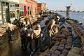 748.9 Clarksville Sandbagging.jpg 512 × 341; 67 KB
 748.9 Floodplain.jpg 1,375 × 697; 104 KB
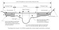
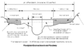 748.9 Flookplain Encroachment and Floodway.gif 899 × 506; 12 KB
 749.11.1.jpg 729 × 170; 33 KB
 749.11.3.jpg 594 × 676; 255 KB
 749.6.1.pdf 2,237 × 2,006, 2 pages; 771 KB
 749 Broad-Crested Weir Coefficients.pdf 1,275 × 1,650; 14 KB
 749 Dimensionless Hydrograph for Small Basins in Missouri.pdf 1,275 × 1,650; 7 KB
- 749 IDF Cen.docx ; 97 KB
- 749 IDF Cen 2019.docx ; 97 KB
 749 IDF Curve District 1.pdf 1,275 × 1,650; 7 KB
 749 IDF Curve District 10.pdf 1,275 × 1,650; 7 KB
 749 IDF Curve District 2.pdf 1,275 × 1,650; 7 KB
 749 IDF Curve District 3.pdf 1,275 × 1,650; 7 KB


