Uncategorized files
Jump to navigation
Jump to search
Showing below up to 50 results in range #7,851 to #7,900.
View (previous 50 | next 50) (20 | 50 | 100 | 250 | 500)
 751.34 equivalent fluid pressure and live load surcharge.gif 538 × 248; 9 KB
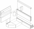 751.34 exploded view of end bent.gif 672 × 590; 20 KB
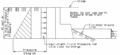
 751.34 limits of earth pressure and surcharge.gif 552 × 145; 4 KB
 751.34 non-integral end bents.gif 495 × 480; 13 KB
 751.34 part section at centerline.gif 744 × 500; 25 KB
 751.34 part section at centerline.jpg 626 × 554; 43 KB
 751.34 part section thru 16in barrier curb.gif 84 × 120; 2 KB
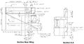
 751.34 part section thru backwall and wing.gif 567 × 459; 13 KB
 751.34 plan of non-integral end bent (skewed).gif 595 × 276; 15 KB
 751.34 plan of non-integral end bent (skewed).jpg 1,221 × 565; 100 KB
 751.34 plan of non-integral end bent (square).gif 597 × 278; 12 KB
 751.34 plan of non-integral end bent (square).jpg 1,095 × 520; 78 KB
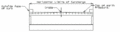
 751.34 safety barrier curb and dimension a-part plan (skewed).gif 576 × 184; 311 KB
 751.34 safety barrier curb and dimension a-part plan (square).gif 587 × 172; 296 KB
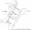
 751.34 wing brace details-skews 0 thru 45.gif 417 × 156; 191 KB
 751.34 wing brace details-skews 45 thru 55.gif 467 × 139; 191 KB
 751.34 wing brace details-skews 55 and over.gif 499 × 138; 202 KB
 751.34 wing layout & elevation a-skews thru 15-LA.gif 533 × 228; 8 KB
 751.34 wing layout & elevation a-skews thru 15-RA.gif 532 × 211; 8 KB
 751.34 wing layout & elevation a-square.gif 504 × 194; 5 KB
 751.35.2.4.2.1.pdf 0 × 0; 587 KB
 751.35.2.4.2.jpg 867 × 730; 187 KB
 751.35.3.3.1.jpg 953 × 505; 70 KB
 751.35.3.3.2.jpg 982 × 697; 89 KB
 751.35.3.3.3.jpg 973 × 544; 85 KB
 751.35.3.3.4.jpg 978 × 533; 97 KB
 751.35.3.3.jpg 1,051 × 610; 88 KB
 751.35.3.3 2017.jpg 1,065 × 612; 93 KB
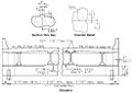
 751.35.3.3 elevation.jpg 952 × 391; 59 KB
 751.35.3.3 keyed.jpg 617 × 237; 18 KB
 751.35.3.3 May 2017.jpg 1,132 × 534; 90 KB
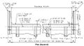
 751.35.3.3 plan skewed.jpg 986 × 493; 90 KB
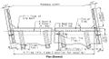
 751.35.3.3 plan squared.jpg 1,017 × 516; 90 KB
 751.35.3.4.1.jpg 939 × 494; 71 KB
 751.35.3.4.2.jpg 979 × 725; 82 KB
 751.35.3.4.3.jpg 861 × 936; 134 KB
 751.35.3.4.jpg 1,007 × 595; 90 KB
 751.35.3.4 2017.jpg 927 × 549; 79 KB
 751.35.3.4 elevation.jpg 907 × 366; 51 KB
 751.35.3.4 keyed.jpg 621 × 237; 18 KB
 751.35.3.4 May 2017.jpg 1,118 × 544; 89 KB
 751.35.3.4 plan skewed.jpg 994 × 468; 86 KB
 751.35.3.4 plan squared.jpg 985 × 505; 79 KB
 751.35.3.5-01.jpg 857 × 395; 33 KB
 751.35.3.5-02.jpg 835 × 418; 55 KB
 751.35.3.5-03.jpg 1,300 × 447; 98 KB
 751.35.3.5-04.jpg 1,000 × 321; 68 KB
 751.35.3.5.jpg 691 × 296; 26 KB
 751.35.3.5 2017.jpg 619 × 257; 23 KB


.gif)
.jpg)
.gif)
.jpg)


.gif)
.gif)